 |
 |
 |
Just as Lewis and Clark decided to spend some time in the Atchison area, you might want to as well. You can do this as a stand alone field trip with two to three hours spent at the various Atchison sites, or you could make a day of it by including the Fort Leavenworth sites as well.
|
|
|
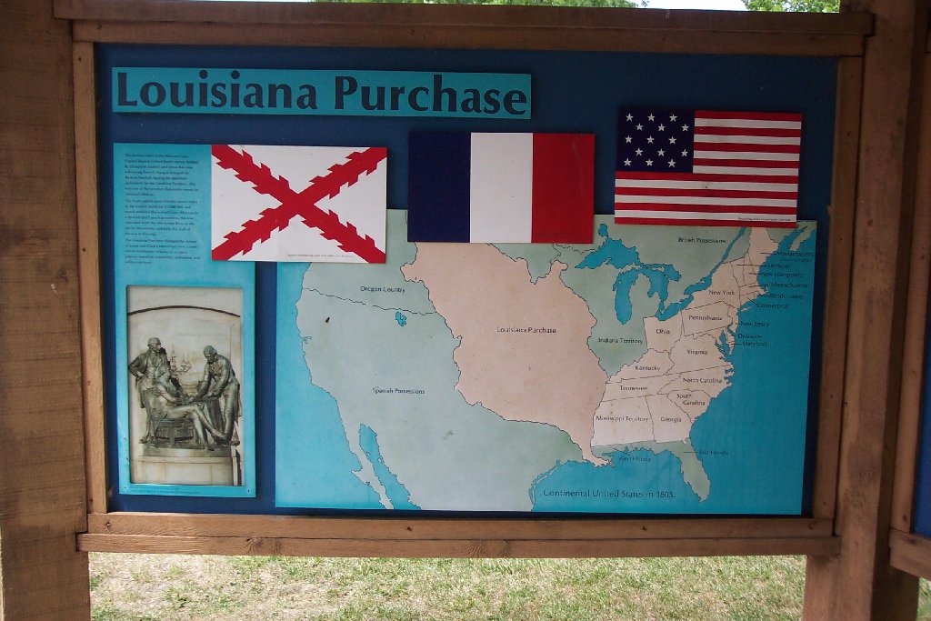
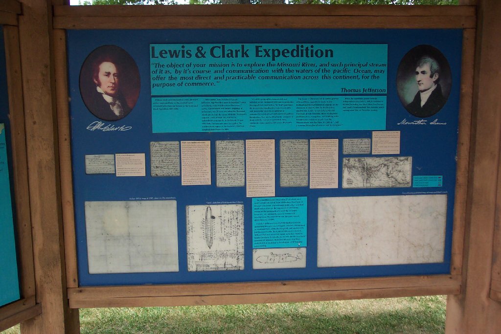
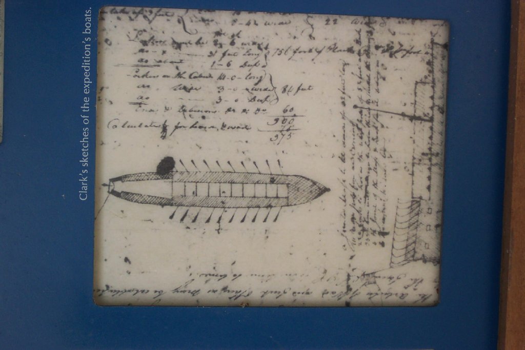
The displays at Lewis and Clark State Park consist of three oversized panels that give background on the Louisiana Purchase and the Lewis and Clark Expedition. The middle panel contains reasonably good reproductions and typescripts of Clark's Journal pages describing their Fourth of July encampment.
Quick Research: Students should be given a map of current
day United States and asked to name the present day states that were carved
out of the Louisiana Purchase.
 |
 |
 |
For the very adventurous, this park also has a very clean camping area that would accommodate an overnight stay about a half a mile or so from the water. It is the only area Lewis and Clark site that allows for recreating the encampment of Lewis and Clark.
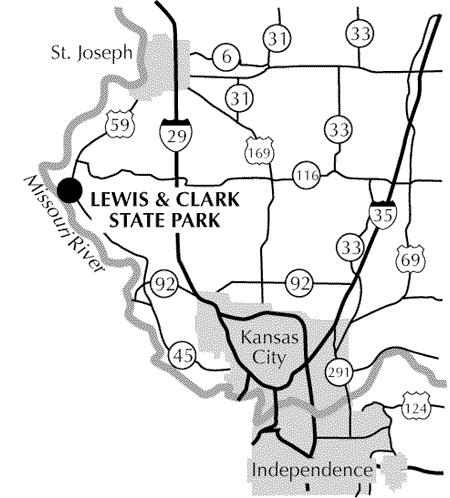
Contact info for Lewis and Clark State Park:
 |
 |
 |
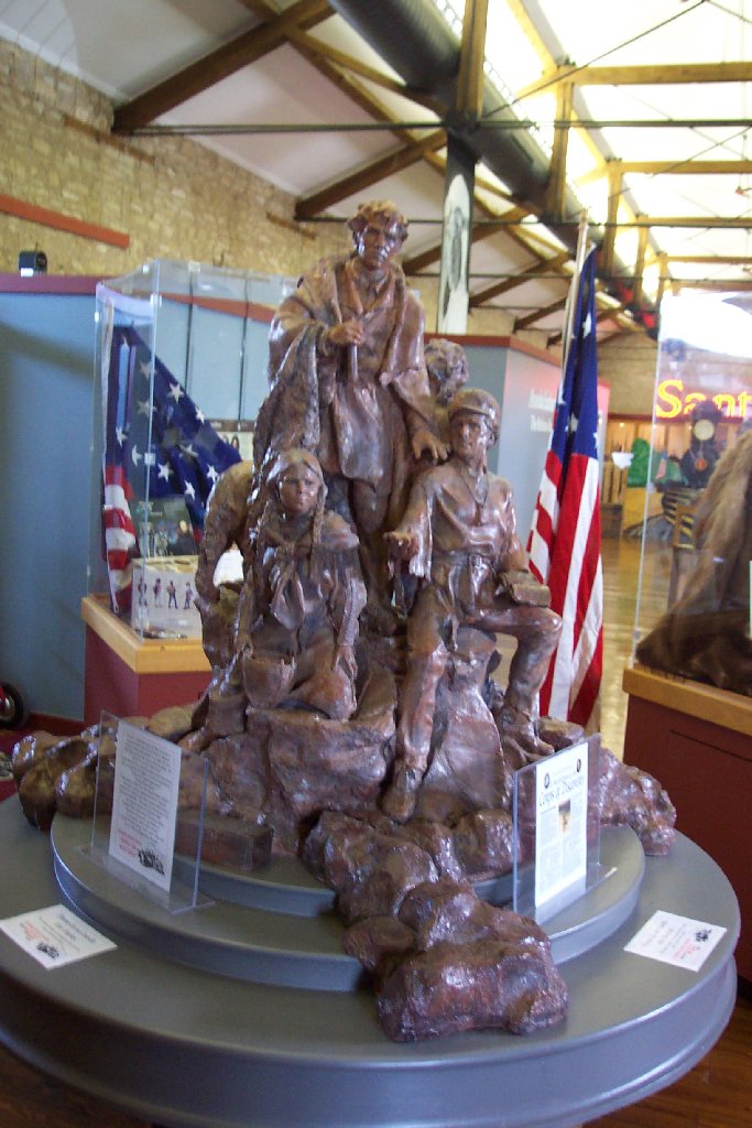
Quick Research: Have the students look for the face at the
end of Seaman's tail.
It is the artist's signature. If you take them to Case
Park on a later trip, be sure to have them see if the face made it
into the final work.
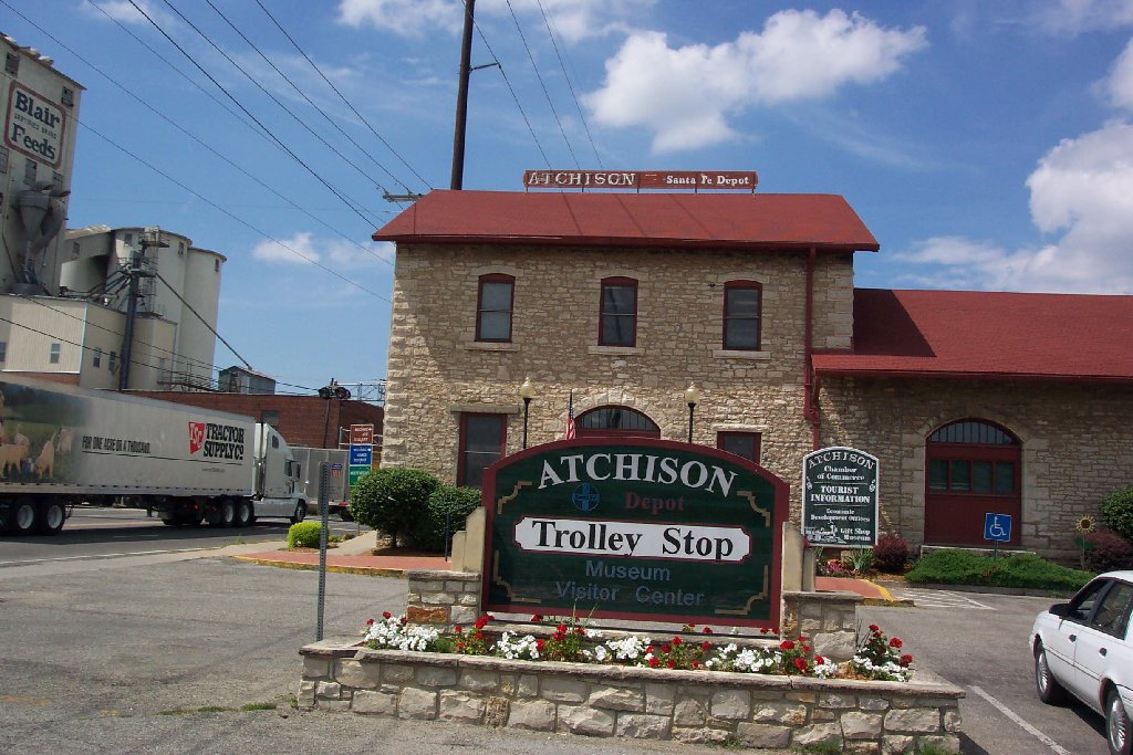
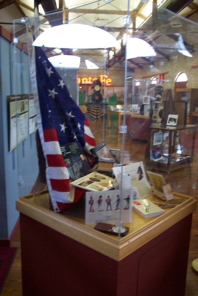
The Atchison County Historical Society Museum has several displays on the expedition, including the artists model of the statue that sits in Case Park in Kansas City, MO.
Lewis And Clark Web Information
http://www.atchisonhistory.org
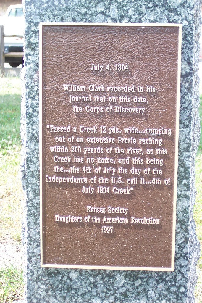
"as this creek has no name, and this being . . . the 4th of July
the day of the independance of the U. S.
call it 4th of July 1804 Creek, . . ." Clark's
Journal, July 4, 1804
 |
|
 |
A Wendy's is just across the parking lot near the creek, and students could walk there. A MacDonalds and Sonic a block over also have spacious parking for trucks and buses.
Quick Research: Have students read the back of the DAR marker. How wide does Clark say the creek was in 1804? How wide is it now?
 |
 |
 |
Independence Park and the river front present a very nice view of the river. The benches and picnic tables along the river front will allow a small group to eat and journal along the river. The signage along the river is minimal. The best location for student journaling is at the park entrance about a quarter mile down the road on the left.
The mound that Lewis walked on is across the road from the Independence Park sign, and is unmarked.
Quick Research: Have the students walk the clear hill within Independence park and record what view they have and speculate on what view Lewis might have had.
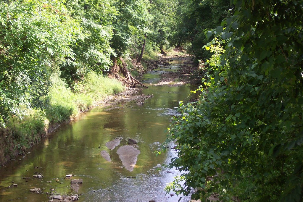
We came to and camped on the lower edge of a plain where the 2d old Kanzas Village formerly Stood., above the mouth of a creek 20 yards wide this creek we call Creek Independence - Clark's Journal, July 4, 1804
 |
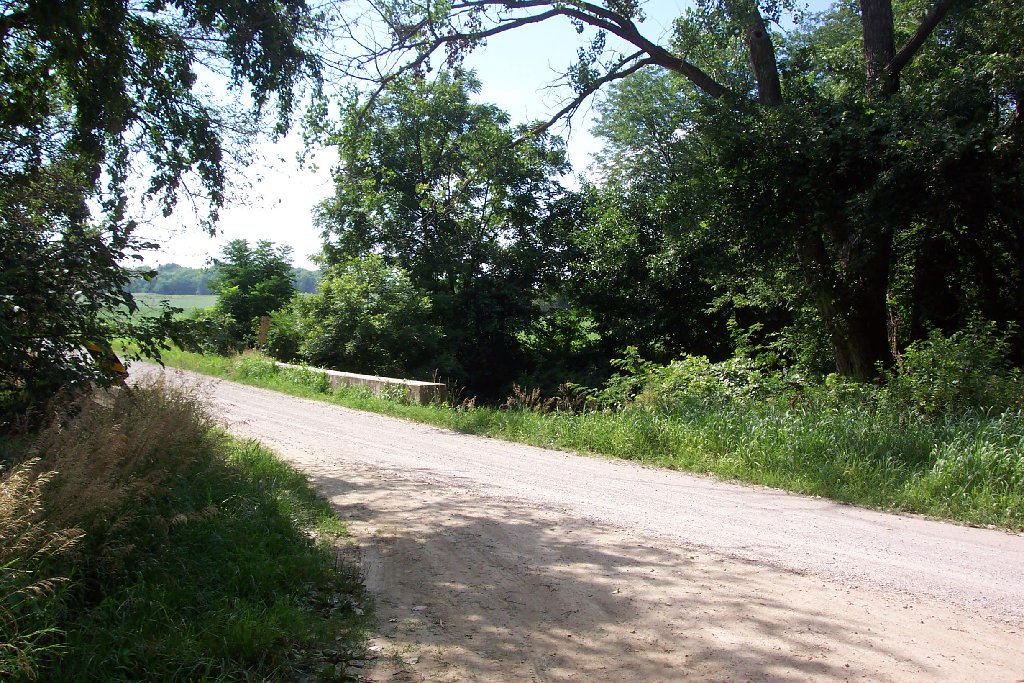 |
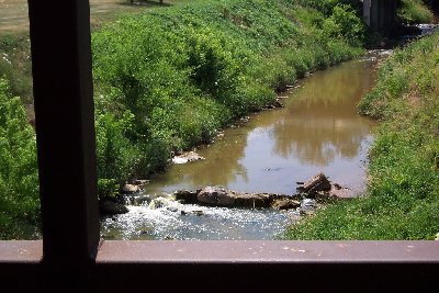
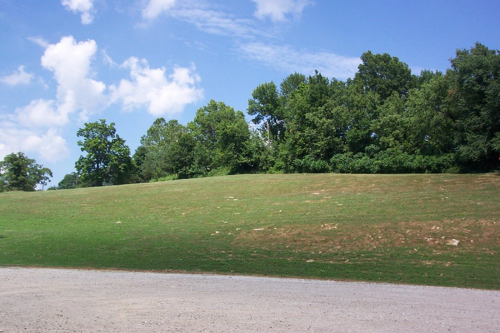
These are two views of the Independence Creek area. This area
is in the process of being purchased and will be developed for interpretation.
Contact Chris Taylor - before making plans to visit this site |